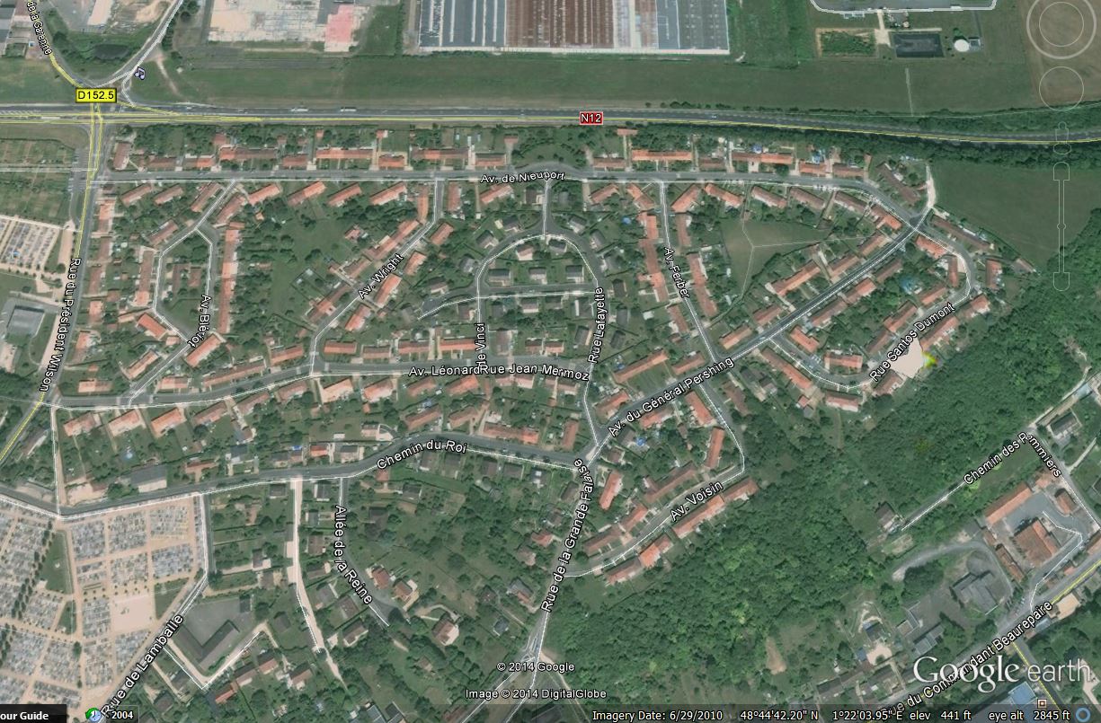
Dreux Base Maps
[table]
,,
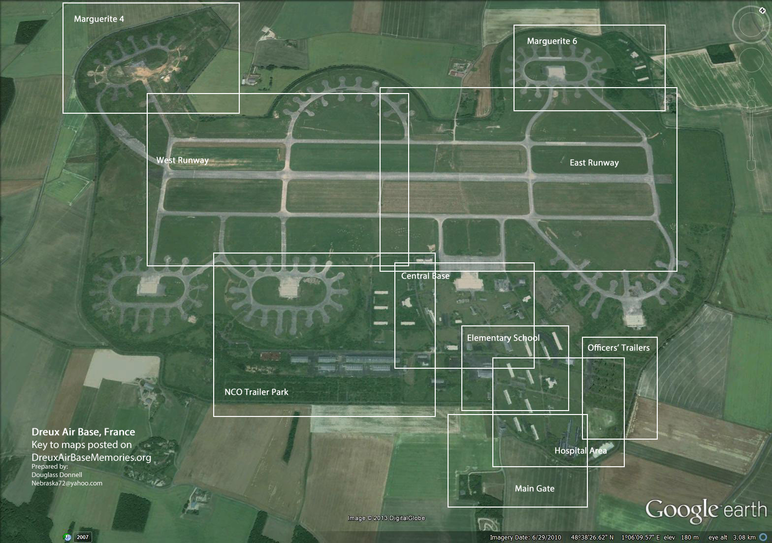
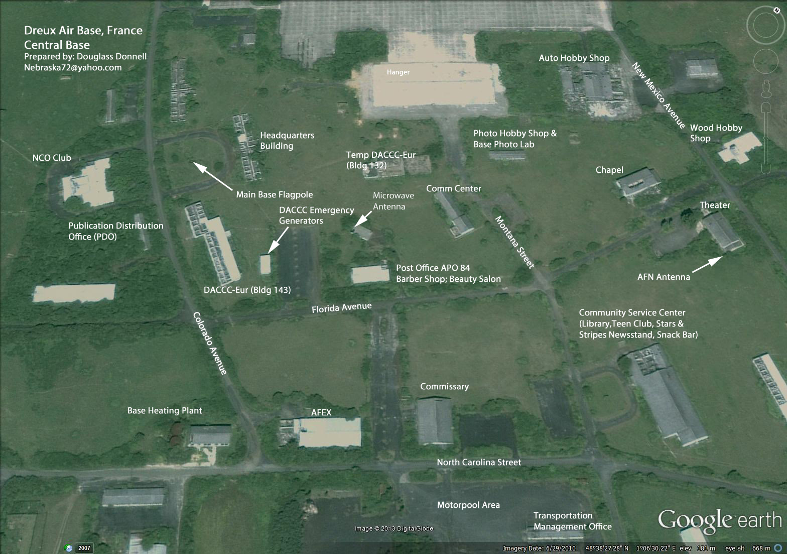
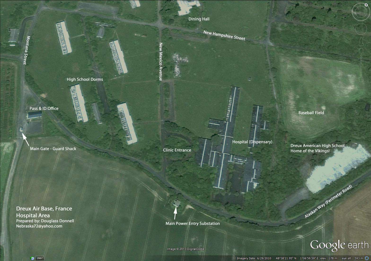
Dreux Maps – Map Key,Dreux Maps – Main Base
Dreux Maps – Central Area,Dreux Maps – Elementary School Area
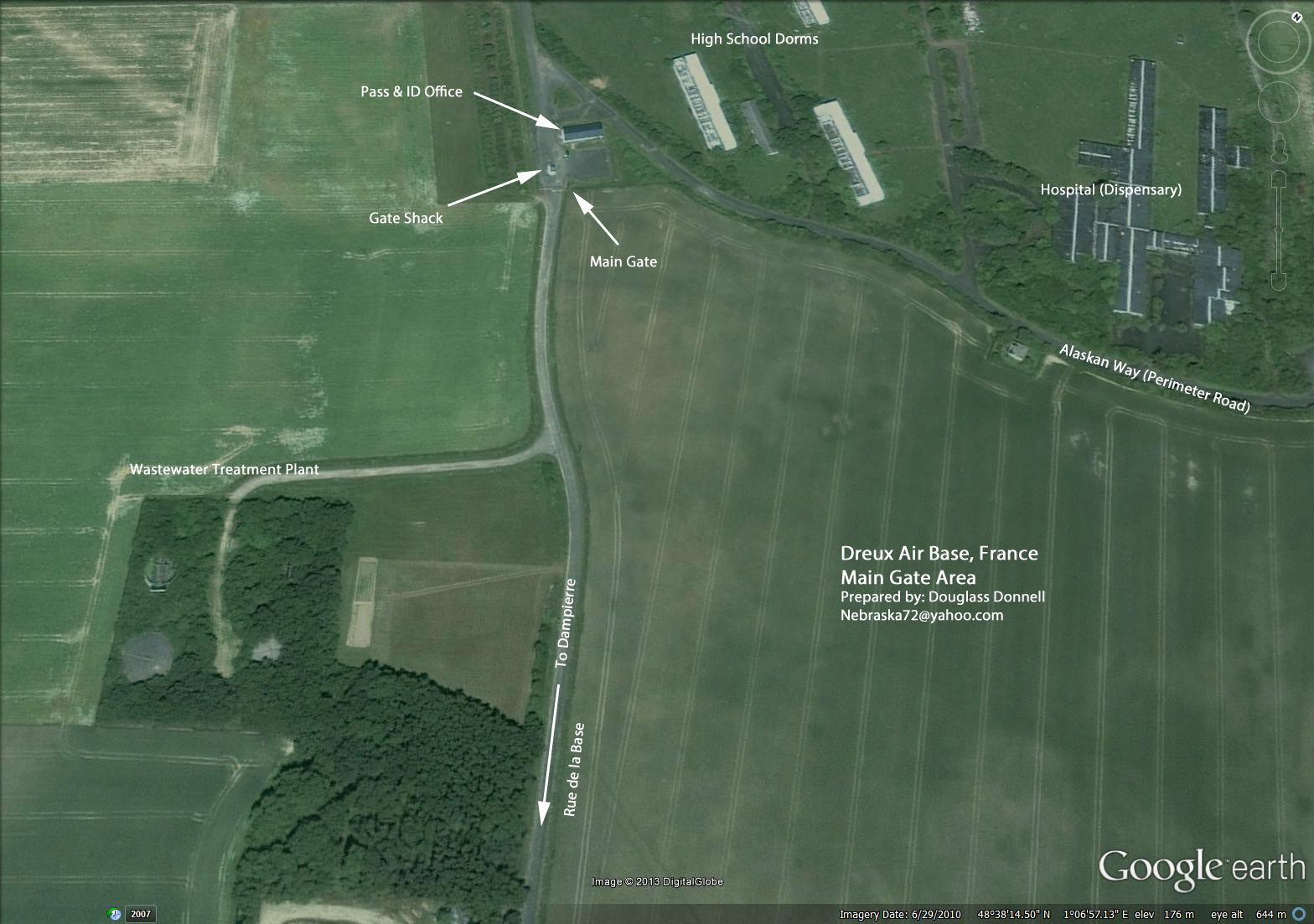
Dreux Maps – Hospital Area,Dreux Maps – Main Gate Area
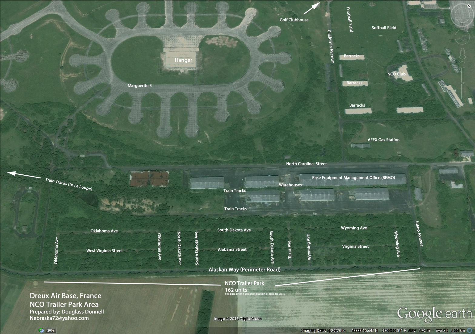
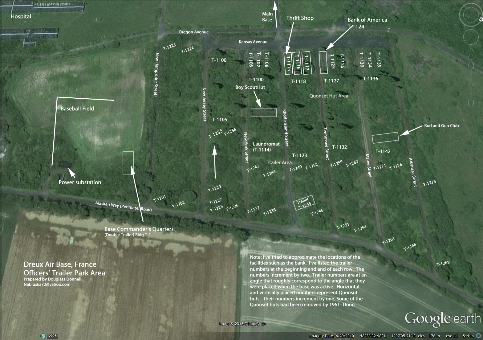
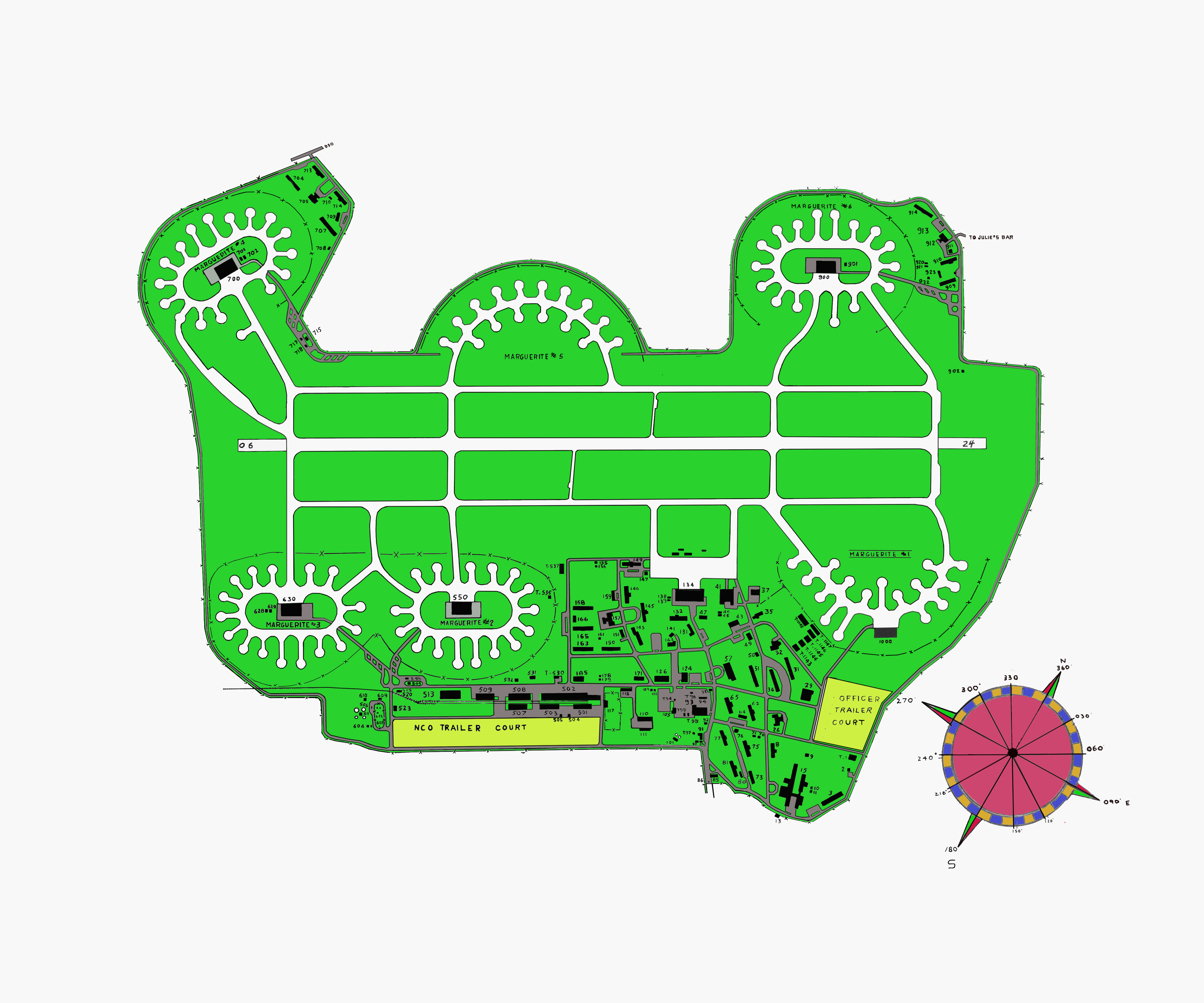
Dreux Maps – NCO Trailers Area,Dreux Maps – Officers Trailers Area
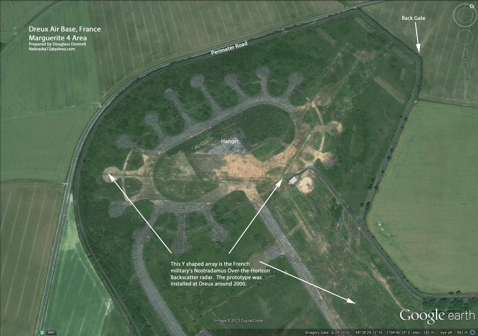
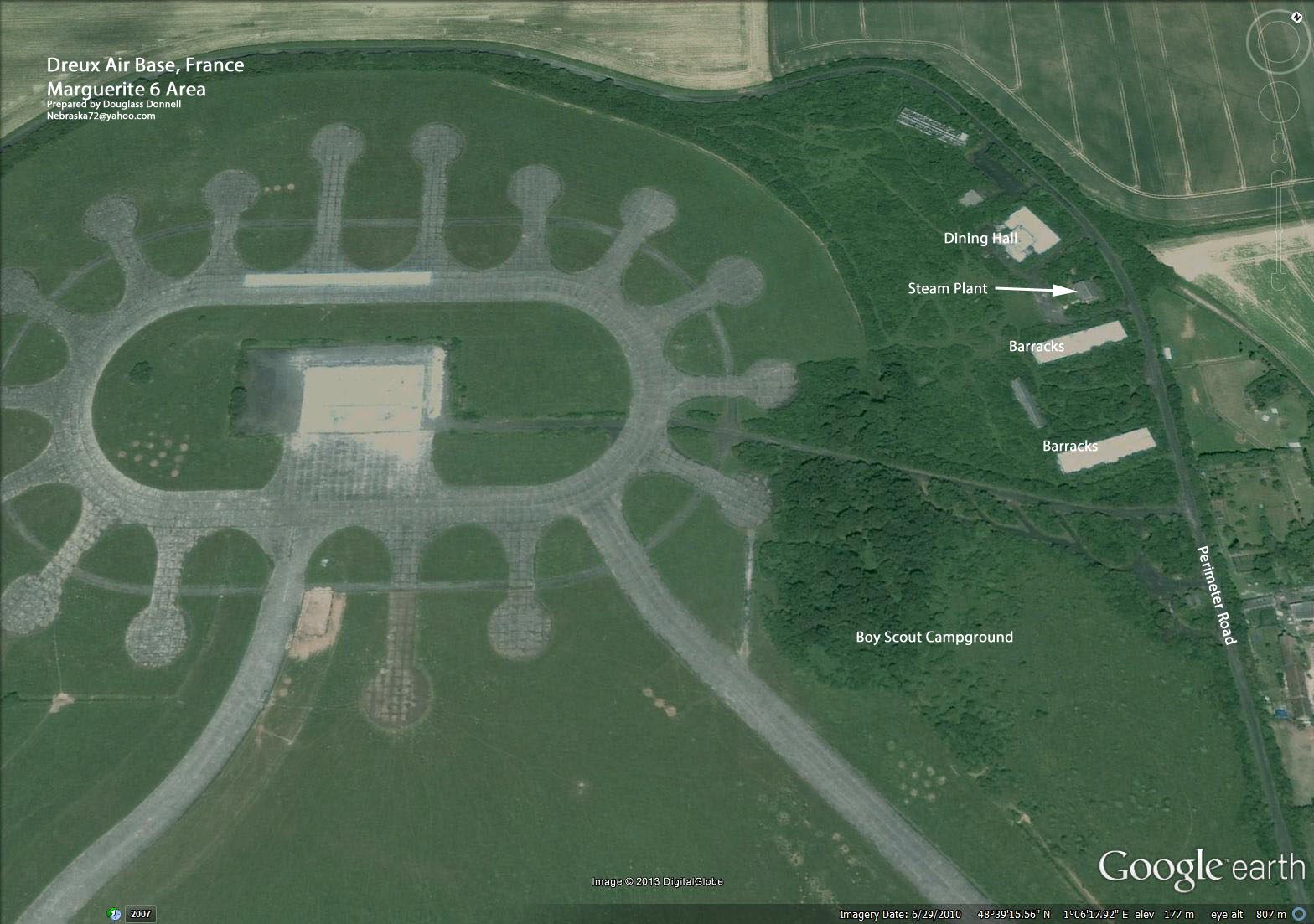
Dreux Maps – Marguerite 4 Area,Dreux Maps – Marguerite 6 Area
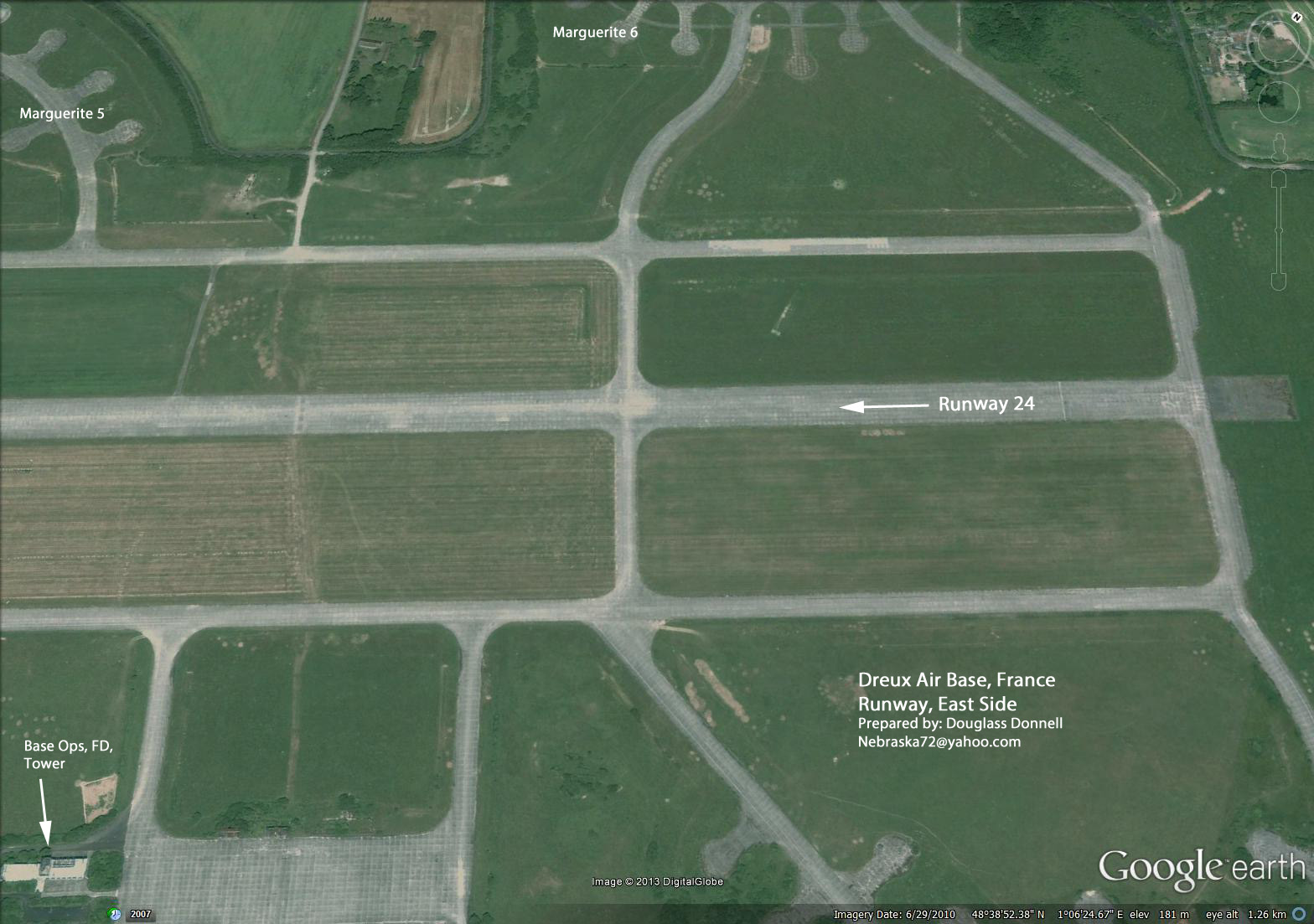
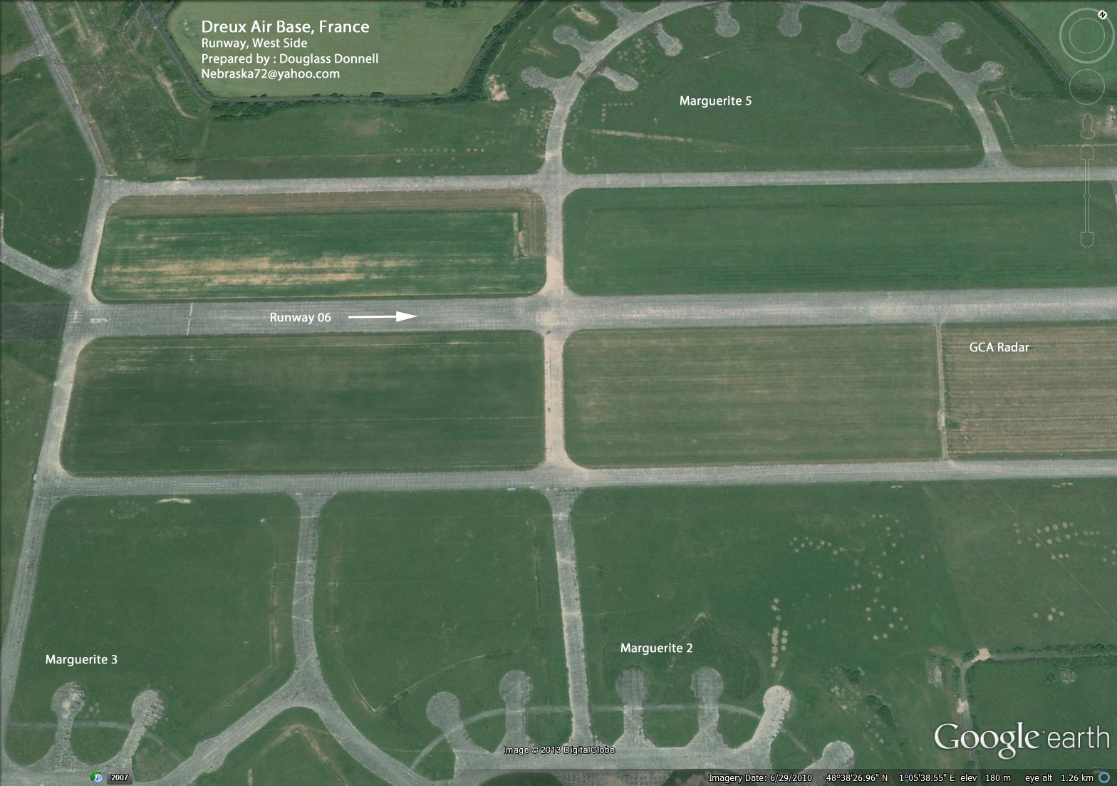
Dreux Maps – Runway East End Area,Dreux Maps – Runway West End Area
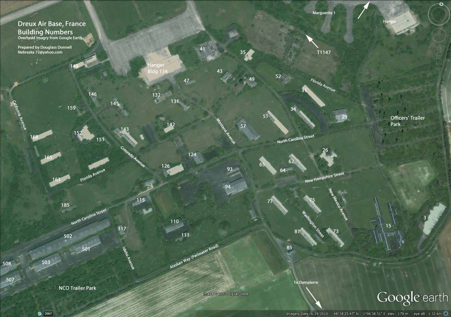
Dreux Maps – Building Numbers,
[/table]
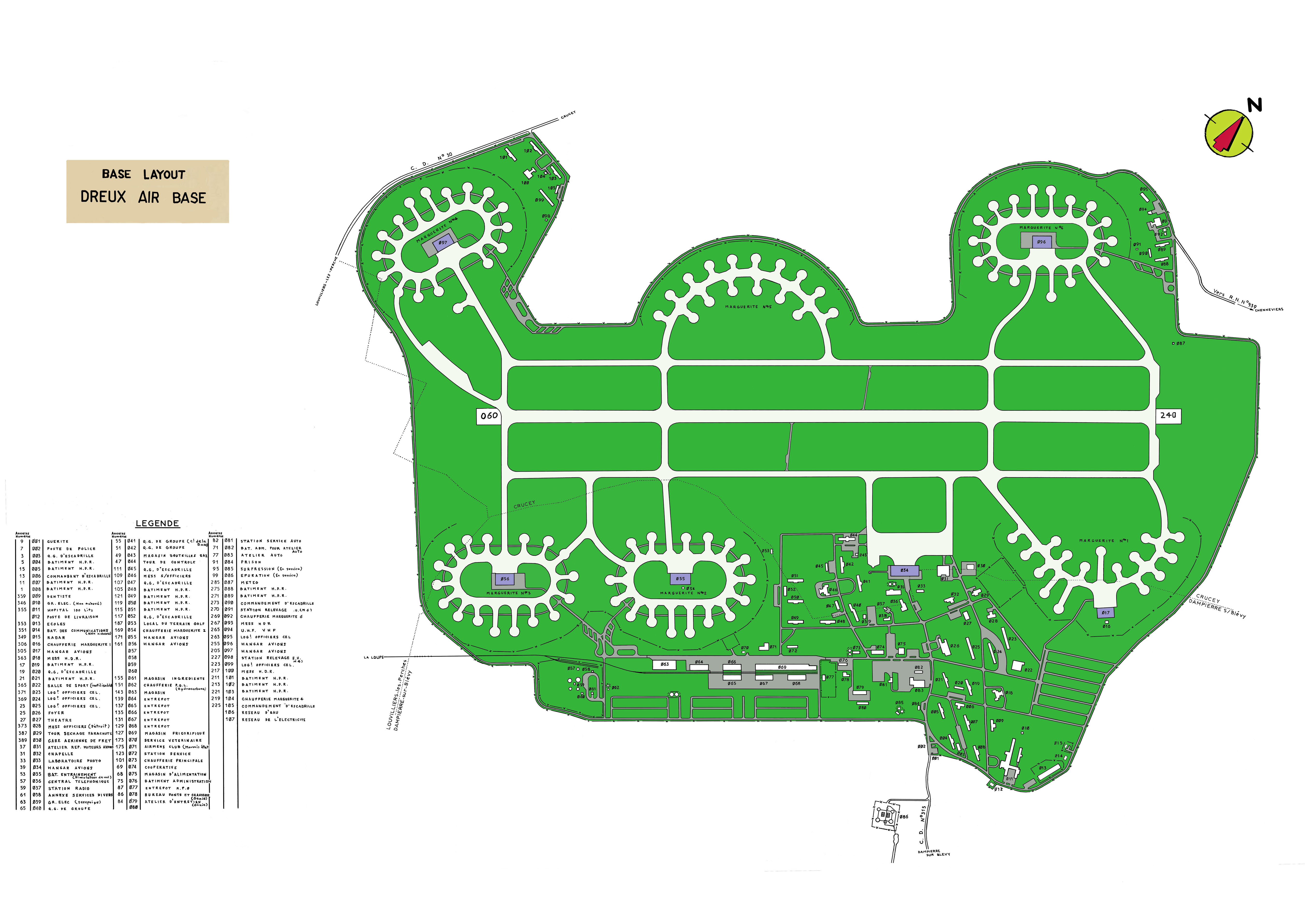
These Maps are by Doug Donnell. He made them using google maps and put the name on an overlay to make them easy to change and to create new ones when we have more information. His email is on the maps. Send him your information. It is easy to see that the use of the buildings changed with the purpose of the base.
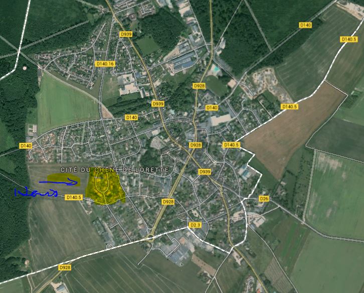
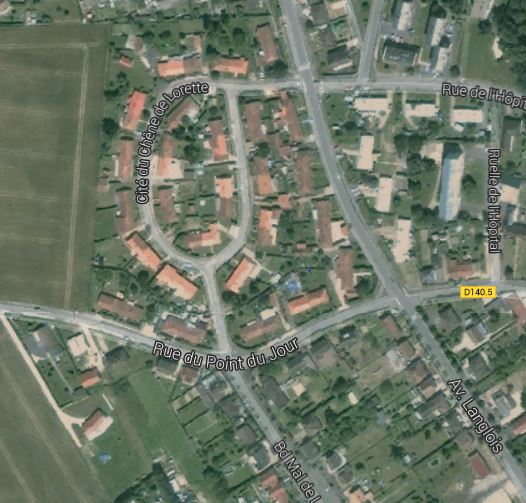
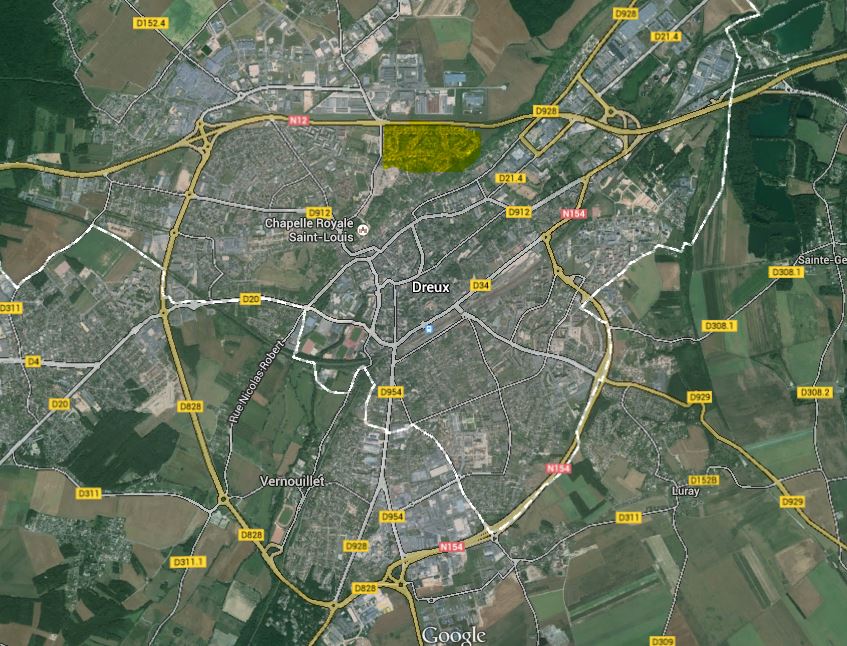
Off Base Housing Area Maps
[table]
,,
Chateauneuf Locator Map, Chateauneuf Housing Street Map, Chateauneuf Ground Level View
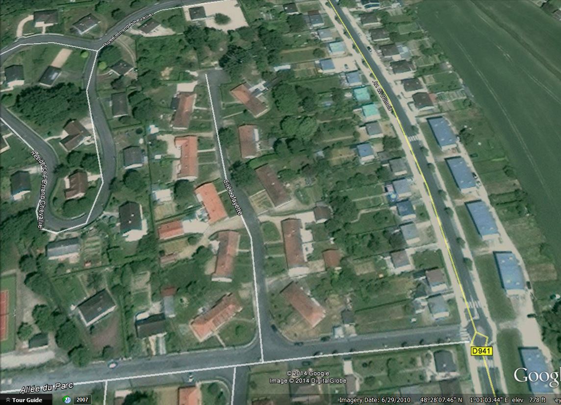
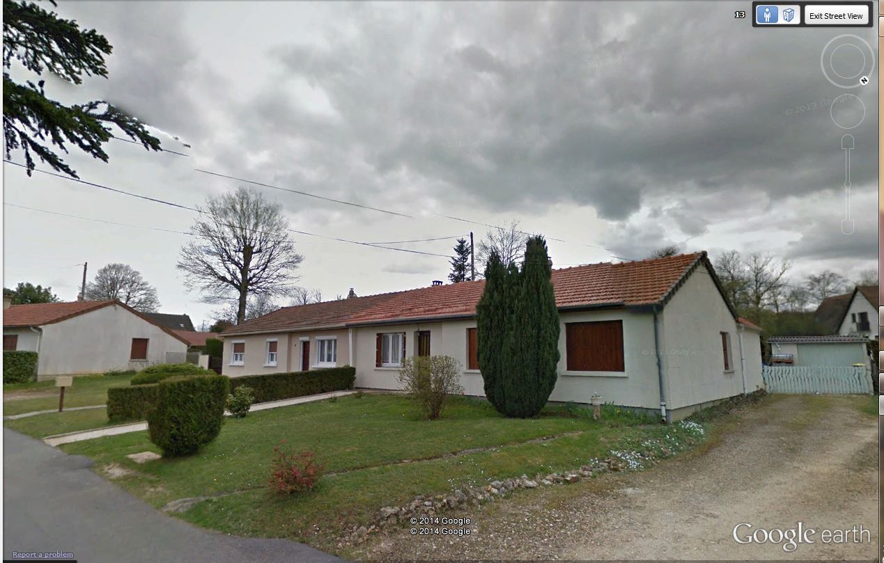
Dreux Locator Map, Dreux Housing Street Map, Dreux Ground Level View
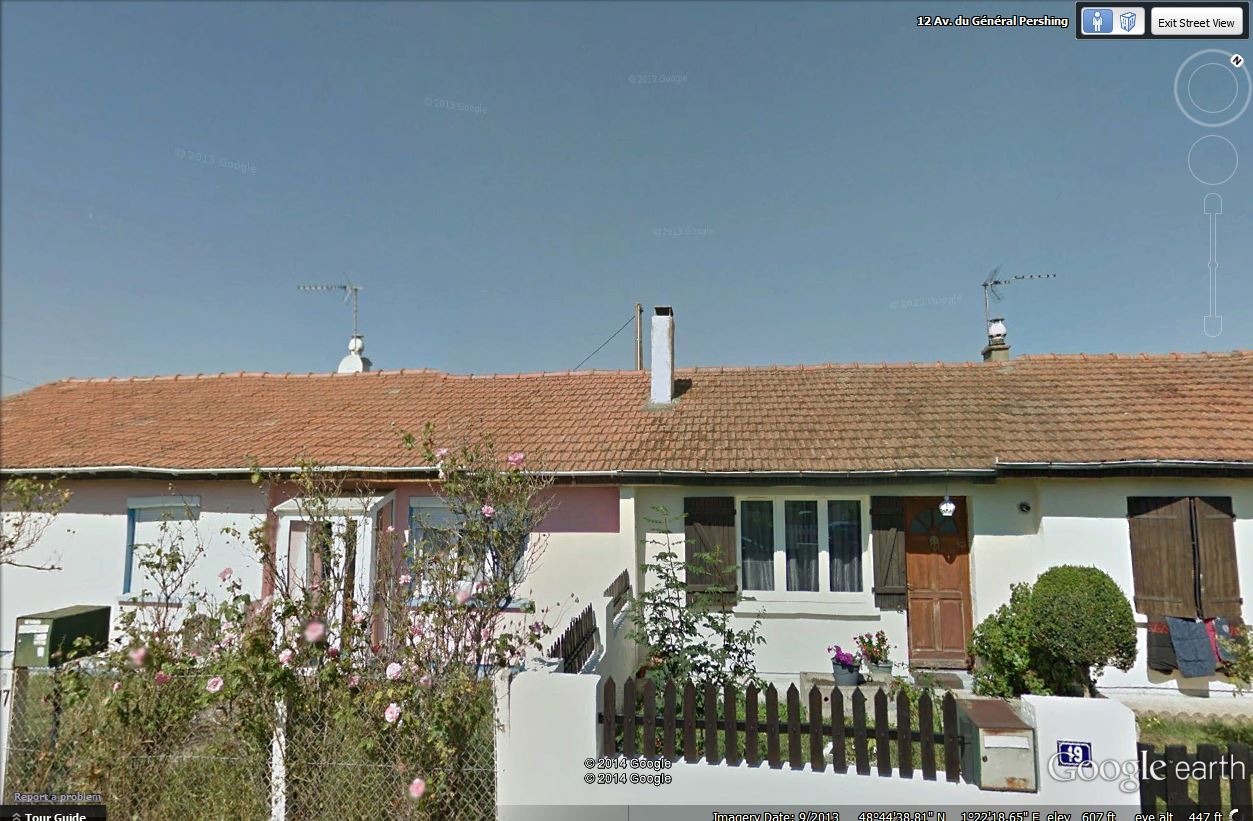
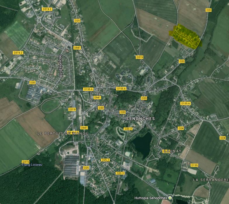
Senonches Locator Map, Senonches Housing Street Map, Senonches Ground Level View
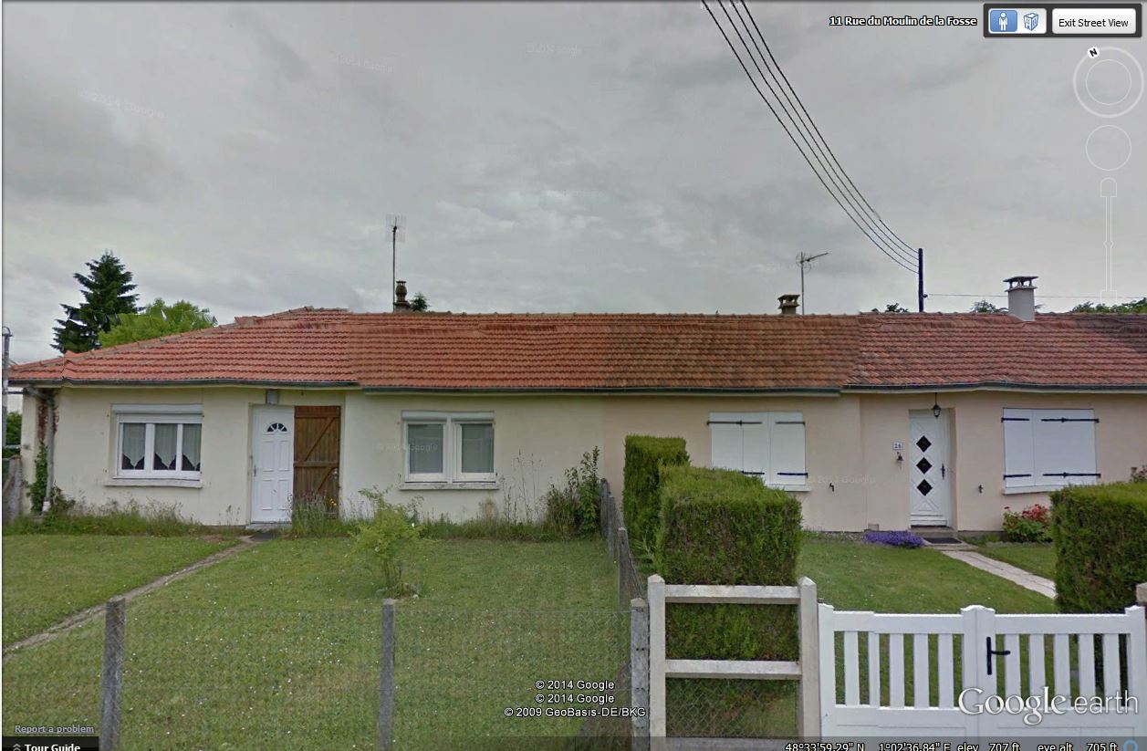
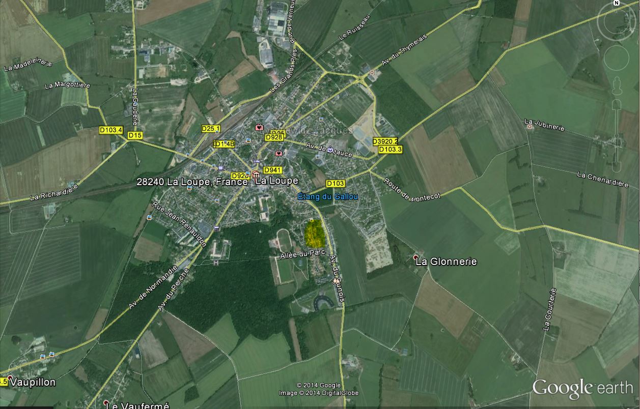
La Loupe Locator Map, La Loupe Street Map, La Loupe Ground Level View
[/table]
Misc Maps
[table]
,,
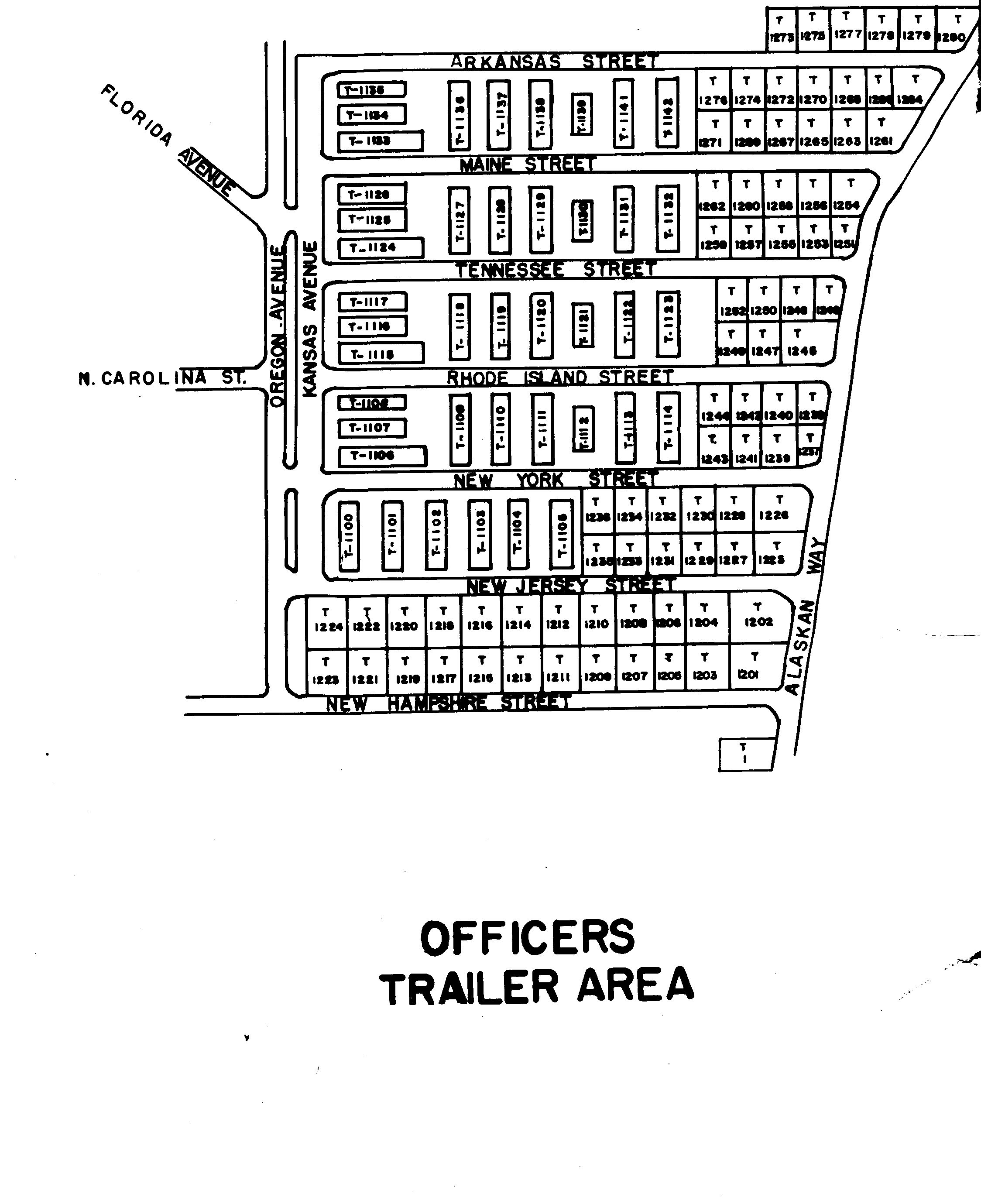
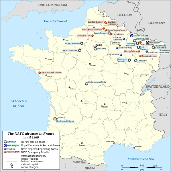
Officer Trailer Park Layout, NATO Bases in France
NCO Trailer Park
[/table]
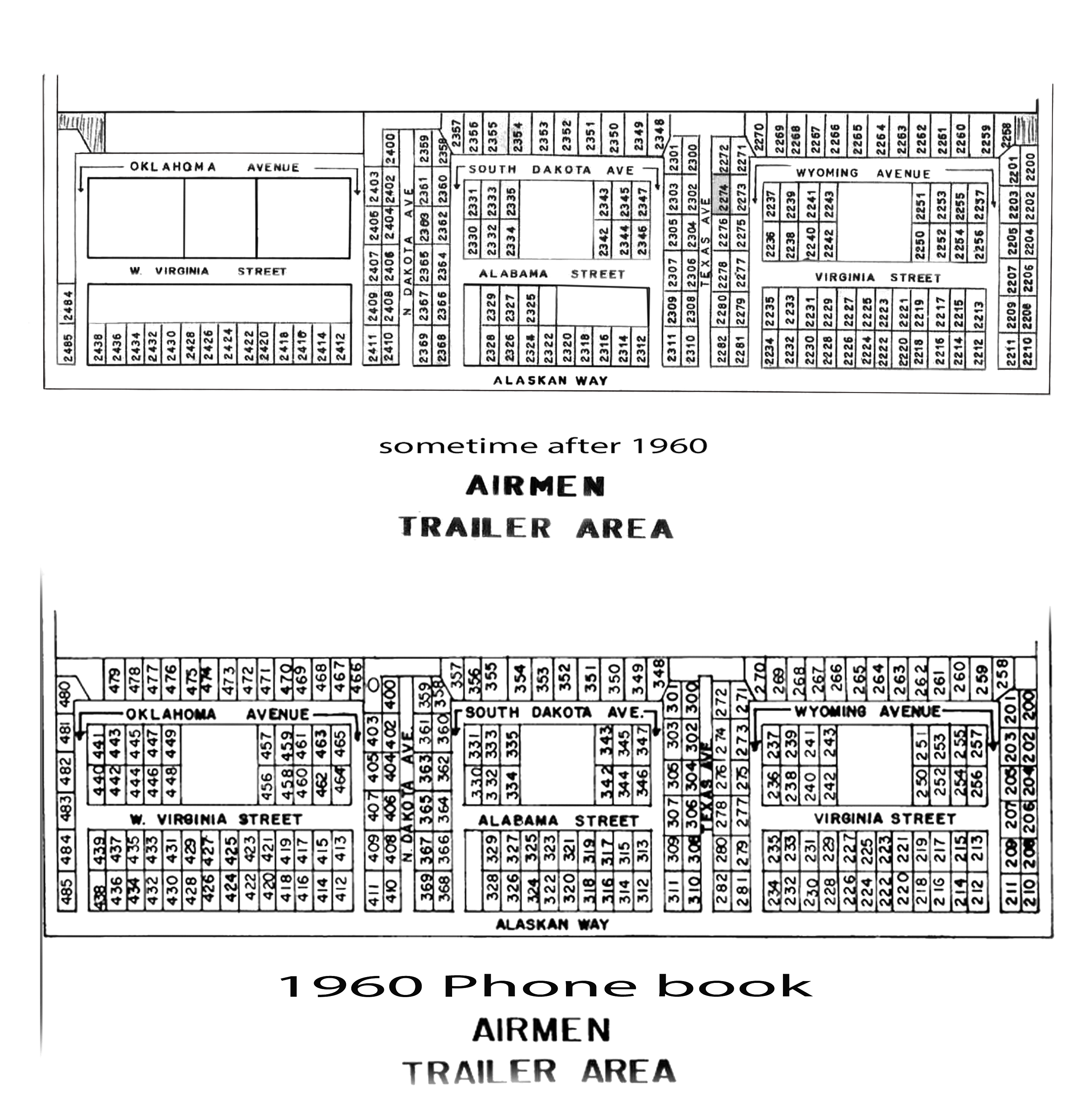
Dreux Air Base Map May 1960 (From Bill Kaufmann’ s phone book -reworked by Bill Mc
Dreux Air Base Map October 1968 ( From our friends at AFCVM)
Service Club Sketch
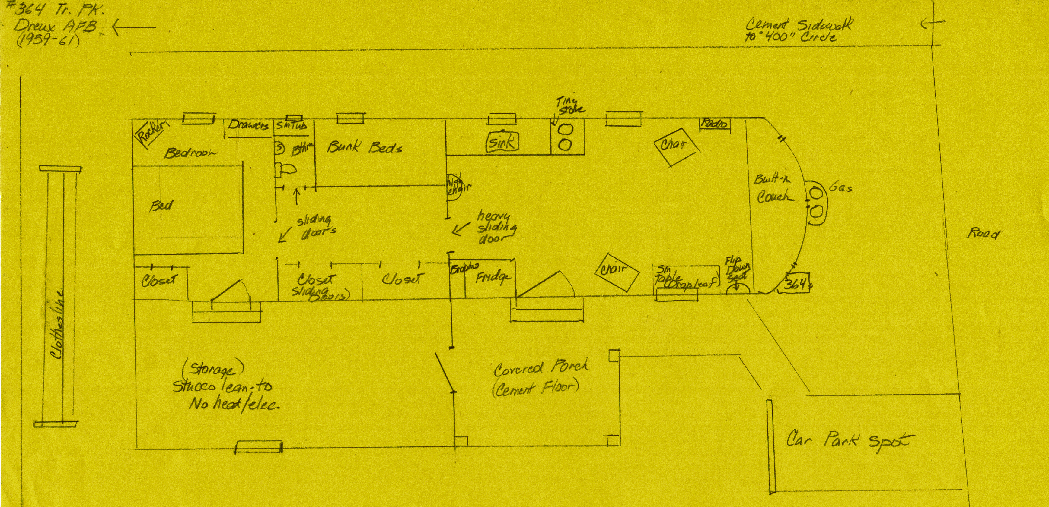
Trailer Layout Sketch